|
| Advocates and City Luminaries Celebrate Gap Closure on Richmond-Ohlone Greenway
New Baxter Creek Gateway Park connects greenways in Richmond, El Cerrito
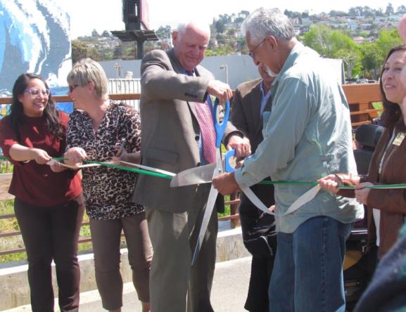
The ribbon was one last obstacle to closing the gap along the Ohlone Greenway between Richmond and El Cerrito. Photos by Melanie Curry/Streetsblog unless indicated otherwise
There’s the Richmond Greenway. There’s the Ohlone Greenway in El Cerrito. And then there was the gap between the two.
This morning advocates joined city councilmembers, mayors, and local legislative representatives to celebrate the completion of a critical improvement to bicycle and pedestrian connections between Richmond and El Cerrito with the opening of Baxter Creek Gateway Park, which connects the two greenways into one continuous band.
It includes nearly 800 feet of new off-street bike lanes, aka Class I trail, 475 feet of restored creek, a pedestrian/bike bridge, and a signaled pedestrian and bicycle crossing at San Pablo Avenue. The project spans San Pablo Avenue next to the BART track crossing and fixes a missing link in the East Bay’s bicycle and pedestrian network.
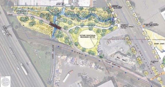
The park and green space that now links the two bike and pedestrian greenways. Image: City of Richmond
More photos of the opening ceremony below.
The project, managed by the City of Richmond Engineering & Capital Improvement Projects Department, was funded in part by Safe Routes to Transit and Urban Greening for Sustainable Communities grants, and Richmond Environmental and Community Investment Agreement funds. It was ten years in the making, and, according to Richmond Mayor Tom Butt, at many points along the way, “They said it couldn’t be done.”
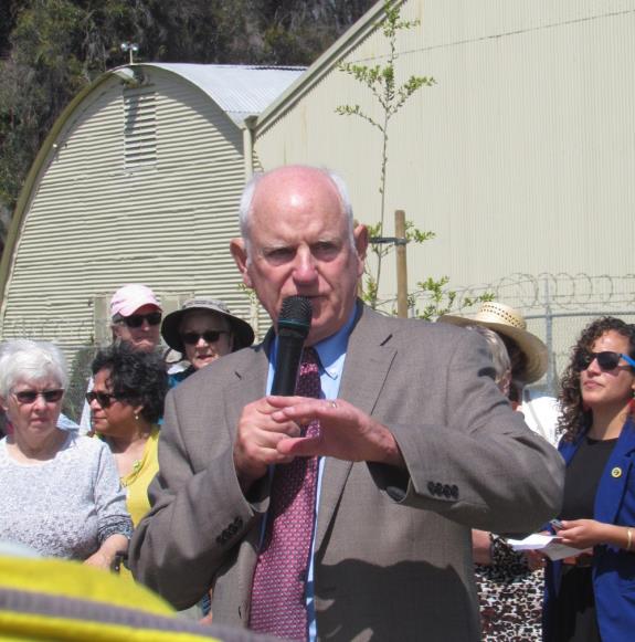
Richmond Mayor Tom Butt narrated the long history behind this gap closure project.
Originally the parcel that includes the bike and pedestrian bridge over the creek was slated for “an ugly block of apartments” with the creek culverted beneath, he said, but the city wanted something better for this connection. The next challenge was building the bike and pedestrian crossing on San Pablo, where there had been nothing before–“The engineers said it can’t be done, can’t be done,” said Butt. Then there was work needed to restore the creek.
“And here we are today,” he said. “The greenway now extends from somewhere on the south side of Berkeley, through Albany, El Cerrito, and Richmond. It connects with the Bay Trail in Point Richmond, and eventually it will connect to the Richmond bridge and into Marin.”
“This will benefit hundreds and hundreds of people,” he said. “It’s a great, great project.”
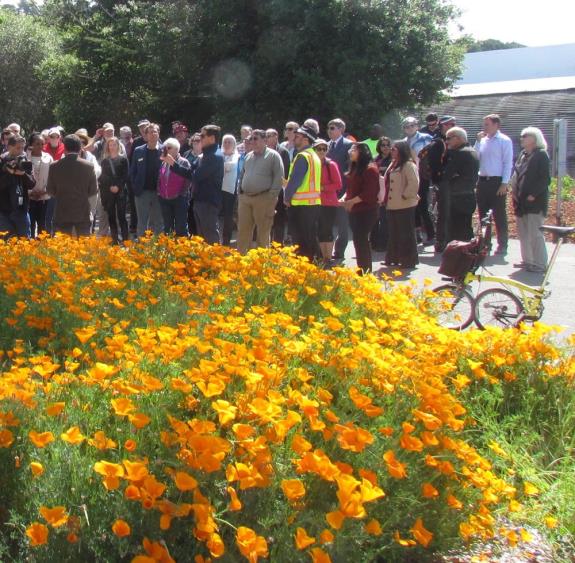
A crowd gathered first on the El Cerrito side of the gap to listen to a few speeches.
“We’re so happy to celebrate another gap closure in our network of regional trails just in time for Bike to Work Day on May 10,” said Susie Hufstader, Community Organizer for Bike East Bay. “If you’re riding to El Cerrito del Norte or Richmond BART, this beautiful car-free path is ready for your commute, especially if you’re trying out biking for the first time during Bike Month this May.”
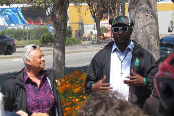
Sarah Calderon and Sherman Dean of Groundwork Richmond explain some of the other work their organization is doing along the Greenway.
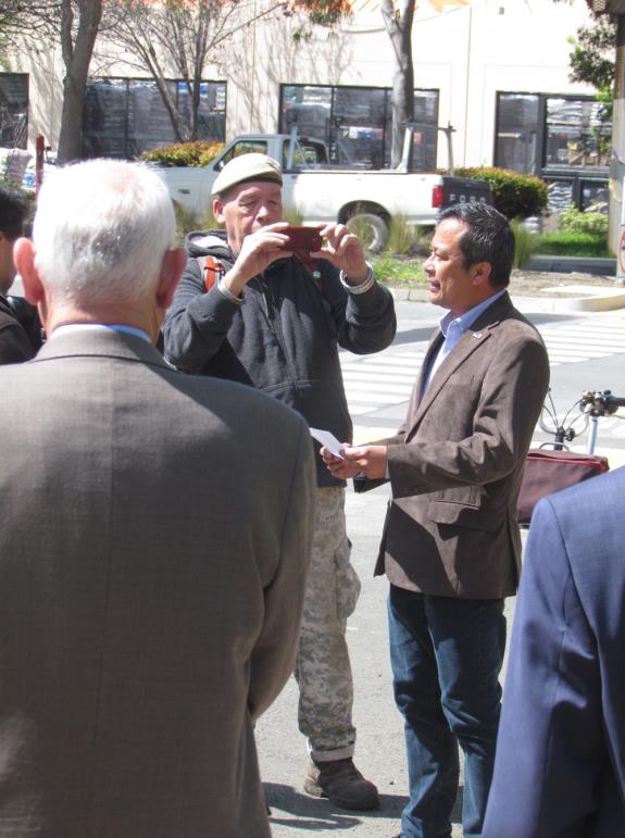
El Cerrito Mayor Gabriel Quinto addresses the crowd.

A new mural looms on the other side of the creek.
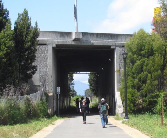
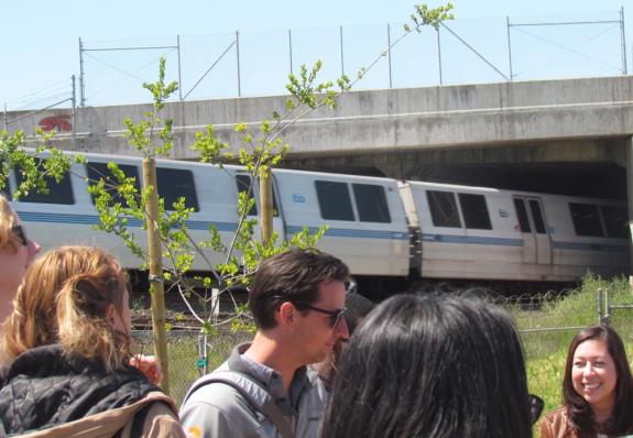
The gap connects El Cerrito to the Richmond Greenway through an underpass beneath the freeway
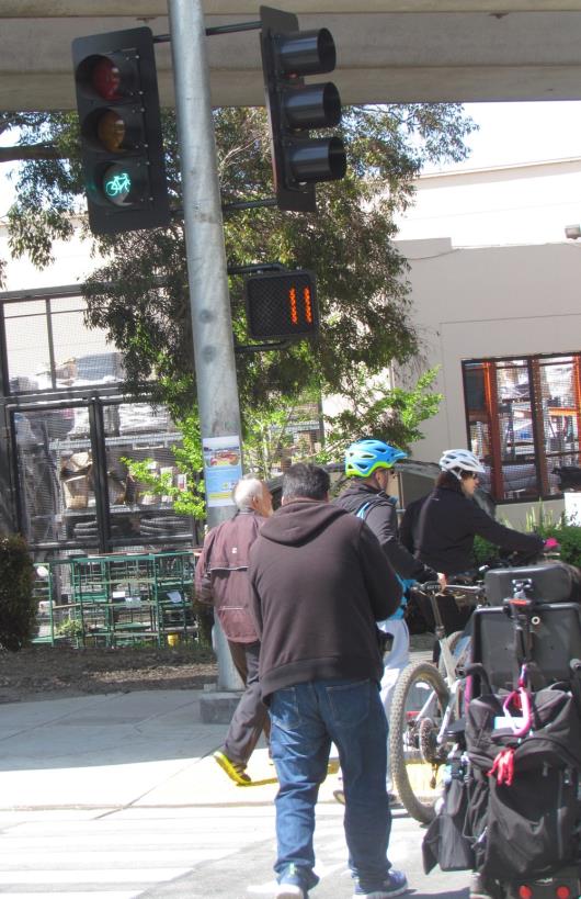
A new bike and pedestrian signal helps people cross San Pablo Avenue at Baxter Creek Park. The Greenway follows the BART tracks into Richmond. This long-awaited project closes a critical gap in the Bay Trail.
|