-
|
|||||||||
 |
|||||||||
-
|
| E-Mail Forum | |
|
|
|
| Lost Coast Life August 16, 2011 |
|
|
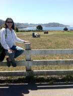
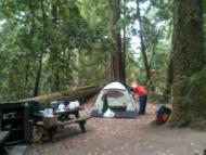
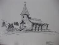
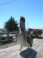
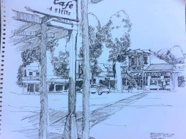
There is nothing quite as evocative in California geography as the “The Lost Coast,” but we had never been there. With only a week squeezed out of an otherwise unusually busy August, this seemed like the place and time to go. The Lost Coast is a strip of northern California coast roughly west of Highway 101 between Leggett to Fortuna so unusually rugged that road builders never dared to go there. The northern area is in the Sinkyone Wilderness State Park, and the southern is in the King Range National Conservation Area. John Geluardi, former Contra Costa Times reporter and award-winning author of Cannabiz, lent me a map and briefed me from his trip a couple of years ago. We got a late start on Monday and camped at Hendy Woods State Park (to be closed next year) along the Navarro River about halfway between Cloverdale and the coast. Tuesday, we drove north on Highway 1 until it reaches the southern tip of The Lost Coast and heads inland toward Garberville and back to Highway 101. A few miles north of Garberville, we turned west again on county roads, going through Humboldt Redwoods State Park and then following the Mattole River to the coast. Below left, a quick stop in Mendocino. North of the road between Highway 101 and the Mattole River is the prime marijuana growing region of Humboldt County, according to Geluardi, who told us not to miss the Honeydew Store, about halfway to the coast. The characters hanging around the Honeydew Store look like the cast from Deliverence. It didn’t look like a place you would want to ask too many questions. We bought ice cream bars and left.
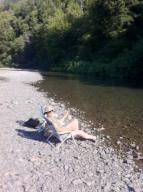
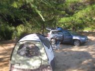
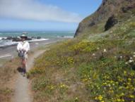
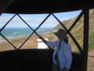
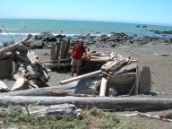
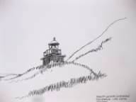
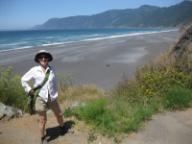
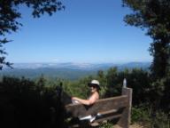
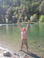
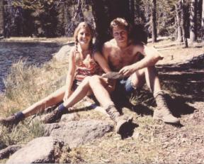
The next morning, we drove to the mouth of the Mattole River marking the northern tip of the Lost Coast. Although we were provisioned for it, we rejected the prospect of doing the three-day, 25-mile hike along the Lost Coast Trail to Shelter Cove. Walking in soft sand with a 40-mph wind and a 40-pound backpack just didn’t seem like that much fun, and we would have had to arrange a shuttle to get back. So the next morning, we took the advice of the proprietor of the nearby Petrolia Store and set off for “Lost Coast Lite,” the 7-mile round trip to the abandoned Punta Gorda Lighthouse. The sun was out, and the wind was at our backs (Everyone is advised to hike the Lost Coast Trail north to south to keep the prevailing winds at their backs). The walk down was pleasant. Wildflowers on the coastal terrace were a treat, and between walking on wet sand at the water’s edge or where the trail followed the coastal terrace on firmer ground, it wasn’t too bad. We had lunch at the lighthouse and then turned into the wind and headed back. I would guess the wind was gusting up to 50 mph, and the trip back was not nearly as much fun. We saw only two people that day Next day, we headed back south, taking the narrow and winding Wilder Ridge Road and King Peak Road to Shelter Cove. One thing you notice about people living adjacent to the roads is that you rarely see a residence or a person. The typical indication of habitation is just a gate and a dirt road leading into the woods. Or, if there is a house near the road, the structure and the yard are obscured by an 8-foot high solid board fence. These people value their privacy. In a similar backwoodsy area, you might appreciate the aroma of pine trees or new mown hay, but along the King Peak Road, the distinctive smell of ripening marijuana prevails. We had never been to Shelter Cove before, but our imaginations conjured up something like Mendocino but more rustic. Shelter Cove, however, was a disappointment. The center of town is an airstrip with a couple of cheap looking motels and cafes. The vacation homes on the steep hillsides look like a low end subdivision in the Central Valley dropped on million dollar lots. It’s too bad, because the Black Sands Beach is absolutely stunning, and from the cliff above the beach you can see halfway up to where the 25-mile Lost Coast Trail starts. On the road out of Shelter Cove towards Highway 101, we camped off the Chemise Road at Wailaki Campground, a beautiful place but the only one where we encountered mosquitoes – a bit of a disappointment. We were almost the only ones there, and perhaps there was a reason. That afternoon we took a short hike up to the top of Chemise Mountain along a part of the southern Lost Coast Trail that runs along the ridge because the coast is impassable. In fact, just south of Shelter Cove is a rock outcropping named “Point No Pass.” It had been years since we had been to Eureka, Arcata and Ferndale, so we made the rounds and then headed east on Highway 299 where the sun came out and the temperature went from 61o to 91 o in about 20 miles. Below, a much younger couple in love in the Trinity Alps in 1971
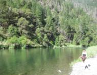
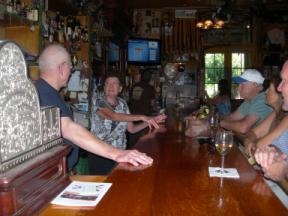
The plan was to be home early afternoon Sunday, so we drove on to Redding and down I-5 and found an unremarkable camping spot at Black Butte Lake, just west of Orland. We were up early Sunday morning and worked our way down the back roads west of I-5, ending up in the Napa Valley. I can tell you, there are some lonely roads out there that look more like Montana or Wyoming than California but are very relaxing. Late morning found us in the Pope Valley near Aetna Springs where we used to hike the Oat Hill Mine Trail over to Calistoga. We stopped at the Pope Valley Winery, a small 100+ year old ranch where “tasting” is more like a wine bar.
|
|
|
|